Lab. of Terrestrial Ecosystem Modeling
Research Faculty of Agriculture, Hokkaido University
-Environmental Sciences on Plant Photosynthesis, Ecosystem Carbon Cycle, and Climate Change-
What are we doing?
We are studying on the interaction of materials (water, carbon, nitrogen, etc.) and energy between terrestrial ecosystem and climate by either or multiple of ecosystem modeling, satellite remote-sensing, and ground measurement.
Current main topics are below!!
Observation and Modeling of Ecosystem Photosynthesis via Solar-Induced Chlorophyll Fluorescence
Forest, grassland, and other ecosystems absorb CO2—a greenhouse gas—from the atmosphere through photosynthesis, and accurately quantifying ecosystem-level photosynthesis is critically important for predicting future climate change. Satellite data are commonly used to capture this quantity over broad spatial scales; however, conventional vegetation indices (such as NDVI and EVI), which reflect only the greenness of leaves, are poorly suited to estimating photosynthetic activity in evergreen forests during winter or in ecosystems experiencing temporary stress from drought and similar conditions.
Photosynthesis utilizes sunlight, but a portion of the light energy that is not used is re-emitted as chlorophyll fluorescence (Solar-Induced Fluorescence, SIF). Until now, SIF had been used primarily for stress diagnosis at small scales, such as the individual leaf level. In recent years, however, it has become evident that at larger, ecosystem-level scales, SIF shows a remarkably high correlation with the rate of photosynthesis (Gross Primary Production, GPP) (Frankenberg et al., 2011; Zarco-Tejada et al., 2013, AFM, among others), raising strong expectations that SIF could be leveraged to estimate ecosystem-level CO2 uptake. On the other hand, validation using ground-based observational data has hardly progressed, leaving the underlying mechanisms unresolved.
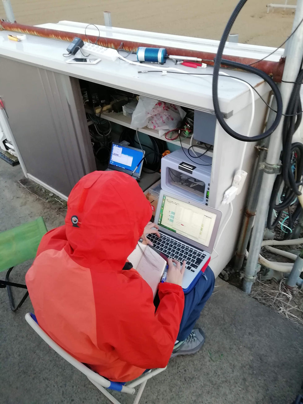
With this in mind, and with the cooperation of many collaborators, we have measured SIF at 10 sites spanning different ecosystem types (paddy field, wheat field, wetland, deciduous broadleaf forest, evergreen coniferous forest, deciduous coniferous forest, young larch plantation, evergreen broadleaf forest, etc.) and have demonstrated a strong positive correlation between SIF and Gross Primary Production (GPP). Building on this, and premised on coupling with radiative transfer models, we are also developing—jointly with JAMSTEC and the National Institute for Environmental Studies—the process-based model FLiES-SIF, which reproduces leaf-level SIF and photosynthesis, as well as the ecosystem carbon cycle model VISIT-SIF.
Ground-based observations:
-
Paddy field (Tsukuba, Buareal et al., 2023, Agricultural and Forest Meteorology)
-
Deciduous broadleaf forest (Takayama, Morozumi et al., 2023, Remote Sensing of Environment)
-
Laurel forest (Okinawa, Fu et al., 2026, Agricultural and Forest Meteorology)
-
Wetland (Bibai, Buareal et al., 2024, JGR-Biogeosciences)
-
Wheat field (Sapporo, Morozumi et al., 2023, Agricultural and Forest Meteorology)
-
Young larch plantation (Teshio, Buareal et al., in prep.)
-
Tropical forest (Pasoh, Malaysia, Morozumi et al., 2026, RSE, in revision)
Three-dimensional radiative transfer / photosynthesis model development:
-
FLiES-SIF (Sakai, Kobayashi, Kato, 2020, GMD)
Ecosystem carbon cycle model development:
-
VISIT-SIF (Miyauchi et al., 2025, GMD; Fan et al., 2025, JGR-Biogeosciences)
Development of SIF retrieval methods using medium-resolution spectrometers:
-
Nakashima et al., 2019, Journal of Plant Research




Development of Physiological-Ecological Process Models
Reproducing Carbon, Nitrogen, and Phosphorus Cycling and Forest Population Dynamics
We are investigating the interactions between climate change and ecosystem responses using VISIT, a terrestrial ecosystem biogeochemical cycling model that estimates carbon, nitrogen, and phosphorus cycling in land ecosystems. Applicable across a wide range of scales—from single sites to the global level—this model serves as Japan's flagship model in this field. In collaboration with the University of Tokyo, the National Institute for Environmental Studies, and JAMSTEC, our research spans a broad range of activities, from adding new model functionality to incorporating results into Earth system models submitted to IPCC reports.Climate change is also highly likely to be accompanied by shifts in vegetation distribution, and we are pursuing more forest-ecology-oriented modeling research—jointly with JAMSTEC—using SEIB-DGVM, an individual-based vegetation dynamics model.
-
Changes in forest carbon balance due to typhoon-induced tree fall (SEIB-DGVM, Wulan et al., 2019, Forest Ecology and Management)
-
Modeling and prediction of non-structural carbohydrates (NSC) (SEIB-DGVM-NSC, Ninomiya, 2023, Geoscientific Model Development)
-
Reproduction and prediction of acorn (masting) production (SEIB-DGVM, Vegh and Kato, 2024, Ecological Modelling)
-
Development and prediction of a Siberian forest fire model (SEIB-DGVM, Nurroham et al., 2024, Biogeosciences)
-
Development of a biogenic volatile organic compound (BVOC) model (VISIT: Chen et al., 2024, JGR-Biogeosciences)
-
Development of a SIF data assimilation system for the ecosystem carbon cycle model (VISIT-SIF: Miyauchi et al., 2025, GMD; Fan et al., 2025, JGR-Biogeosciences)
-
CO2/temperature acclimation of photosynthesis and its incorporation into an Earth system model (VISIT, MIROC-ES2L: Nam et al., in prep.)
-
Incorporation of phosphorus cycling into VISIT and an Earth system model (VISIT-CNP, MIROC-ES2L)


Broad-Scale Estimation of Forest Structure Using Machine Learning/Deep Learning Combined with Ground, Airborne, and Satellite Data
While countries around the world are pursuing efforts toward carbon neutrality under frameworks such as the Paris Agreement, accurate estimation of carbon uptake by forests—a major carbon sink—is essential for carbon credit trading. To date, however, this has been hampered by problems such as low spatial resolution or, in many cases, the absence of any spatially explicit estimation at all.To address this, we have applied machine learning to airborne laser scanning (LiDAR) data and, using satellite data as input, have successfully mapped forest aboveground biomass and related variables at ultra-high resolution (10 m/pixel). Going forward, we plan to extend this approach to applications such as tree mortality detection and tree species classification.
-
Estimation for Japanese cedar/cypress in Ibaraki Prefecture and broadleaf forests in Oita Prefecture (Li H. et al., 2022, Remote Sensing; Li H. et al., 2022, Geocarto International)
-
Estimation of forest aboveground carbon storage across Taiwan (Nguyen et al., in submission)
-
Estimation of forest aboveground growth rates using multi-year airborne LiDAR data from Tomakomai Experimental Forest (Li A. et al., in submission)
-
Ultra-high-resolution estimation of forest aboveground carbon storage across Japan (Li H. et al., 2024, Remote Sensing of Environment)Improvement of a forest aboveground biomass model for Japan using GEDI LiDAR (Li H. et al., 2025, Forest Ecology and Management)
-
Geolocation correction of GEDI using Japanese ALS data (Li H. et al., 2024, Science of Remote Sensing)


Development of Crop Models and Reconstruction/Projection of Crop Yields Using Statistical Records
As the world's population continues to grow rapidly, the demand for increased food production rises year by year. At the same time, future climate change is projected to have a major impact on agricultural production (IPCC, 2014), and determining how to invest limited economic resources to avoid a food crisis is critically important—not only for Japan's food security but for national security more broadly. Over the past 100 years, atmospheric CO2 concentration has risen from 280 ppm to 400 ppm, and global mean temperature has increased by 0.7°C (IPCC, 2014). In other words, climate change is already underway, and its relationship with crop yields has been examined using agricultural statistics (e.g., Lobell et al., 2011, Science). However, the datasets used, such as those from the FAO, are at the national level and do not account for regional differences in climate characteristics. Moreover, these analyses have generally focused on the relatively recent past (30–50 years), a period over which the effects of mean climate change are not necessarily pronounced. This limited scope of analysis can be attributed to the fact that detailed statistical records have not been digitized, and to the difficulty of disentangling the effects of concurrent agronomic improvements such as cultivar breeding.
At the same time, rice—Japan's most important crop—has seen yield declines driven by climate factors, such as the cold-damage-induced shortfall known as the "Heisei Rice Crisis" of 1993, and, more recently, heat-stress-related yield reductions concentrated in western Japan due to rising temperatures, making the study of adaptation measures to climate change an urgent priority (Kawazu et al., 2007, Japanese Journal of Crop Science). Japan is also rare worldwide in that data on crop yields and farming practices—including fertilizer use and agricultural machinery—for major crops such as rice and wheat have been published by prefecture since as early as the 1880s. This makes it possible to use these records to examine the impact of climate change on crop yields across a time span long enough to reliably detect climate change signals, and across a spatial extent broad enough to capture differences in cultivar and climatic resources. To do this, it is necessary to statistically analyze the relationship between genetic and environmental factors and long-term, prefecture-level crop yield data extending back to before the Industrial Revolution, in order to quantitatively extract the historical impact of climate change on Japan's crop production.
In this research, we combine approximately 110 years (1901–2012) of prefecture-level agricultural statistics on Japan's major crops (rice, wheat, barley, soybean, sweet potato, and potato), results from agricultural experiment station trials, and simulations from the crop yield model MATCRO, to elucidate the relationships between crop yield and genetic traits (standard yield, nitrogen responsiveness), nitrogen fertilizer application, and climate variability (temperature, precipitation, solar radiation, and CO2 concentration). This work provides essential foundational data for developing adaptation measures to avoid future climate-change-driven declines in crop yields.
-
Elucidation of long-term yield variability in major crops (Japan, 1883–2022, Buareal et al., 2025, Scientific Data; France, Schauberger et al., 2018, Scientific Reports; Schauberger et al., 2022, Scientific Data; Thailand, 1918–2023, Kongsurakan et al., 2025, Field Crops Research; India, 60 years, Li X., 2026, Field Crops Research)
-
Digitization of early modern Japanese rice yield records ("inekaricho" harvest ledgers) and elucidation of their relationship with climate change
-
Development of global process-based crop production models (soybean, Yusara et al., 2025, GMD; maize, Nagata et al., 2025, GMD; wheat; potato, Nakao et al., in prep.; cassava; sugarcane)
-
Reproduction of rice yield variability and quantitative elucidation of contributing factors through data assimilation of statistical records into crop production models (Japan, Nakagawa, in prep.; Asia, Nakagawa, in prep.)


